


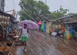
The Ghana Meteorological Agency (GMet) has issued an Impact-Based Weather Warning alerting the public to an incoming rainstorm expected to affect several parts of the country, with the risk of thunderstorms, moderate winds, and possible flash flooding in low-lying areas.
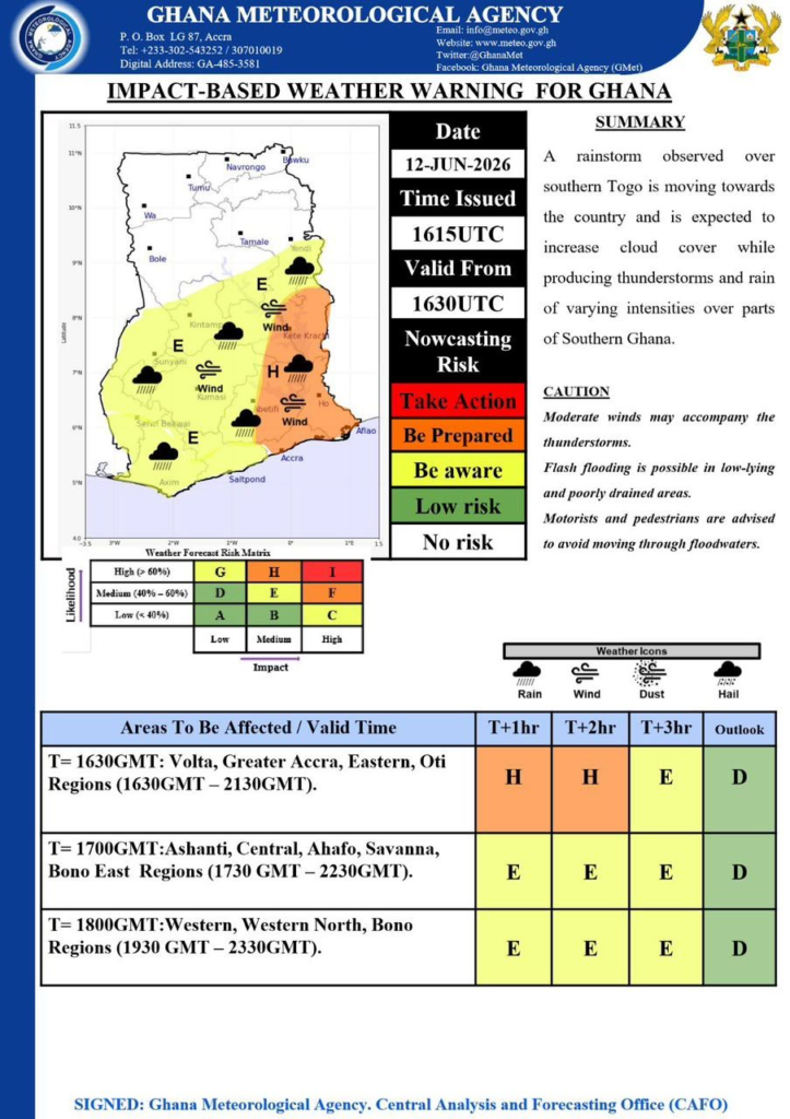
According to the warning issued on Friday, June 12, 2026, at 1615 UTC and valid from 1630 UTC, a rainstorm observed over southern Togo is gradually moving towards Ghana. The system is expected to increase cloud cover and trigger thunderstorms and rainfall of varying intensities across southern Ghana and other parts of the country as the evening progresses.
GMet cautioned that the weather system may bring moderate winds accompanying thunderstorms, while flash flooding remains possible in poorly drained and low-lying communities. The public, particularly motorists and pedestrians, has been advised to avoid driving through floodwaters to reduce the risk of accidents and disruptions.


Areas Expected to Be Affected
The agency indicated that different regions will experience the storm at staggered times:
- From 1630 GMT to 2130 GMT, Volta, Greater Accra, Eastern, and Oti Regions are expected to be the first to experience the system, with a high to moderate risk of severe weather impacts.
- Between 1730 GMT and 2230 GMT, Ashanti, Central, Ahafo, Savannah, and Bono East Regions are expected to be affected by thunderstorms and rainfall activities.
- Later in the evening, from 1930 GMT to 2330 GMT, the Western, Western North, and Bono Regions are also expected to come under the influence of the weather system.
The forecast risk matrix shows varying levels of likelihood and impact across the affected zones, with some areas marked for higher alert levels in the early hours of the storm’s movement.
GMet has urged residents in all projected areas to remain alert and take precautionary measures as the weather system progresses inland.


